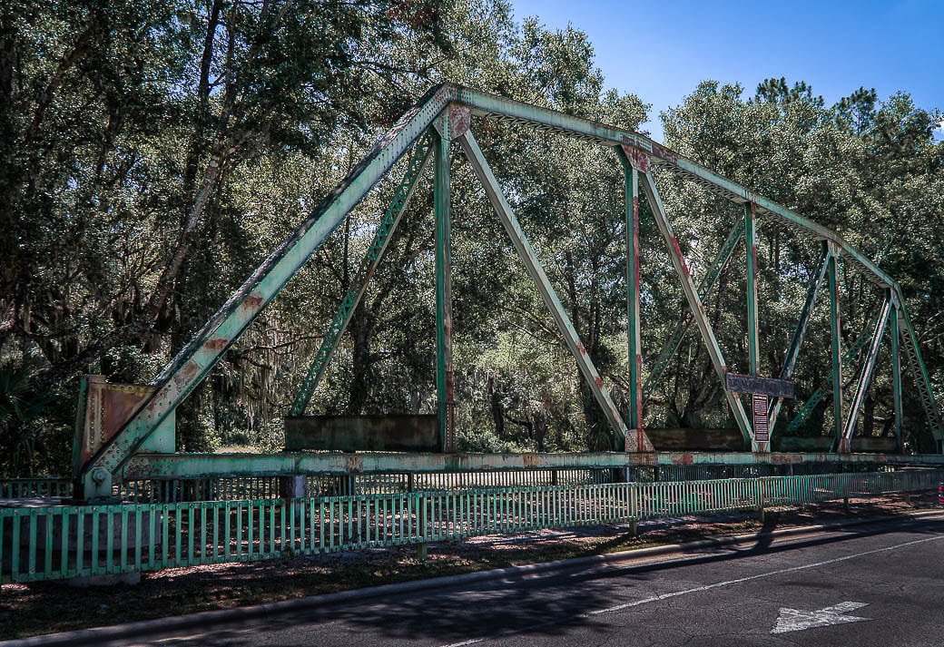
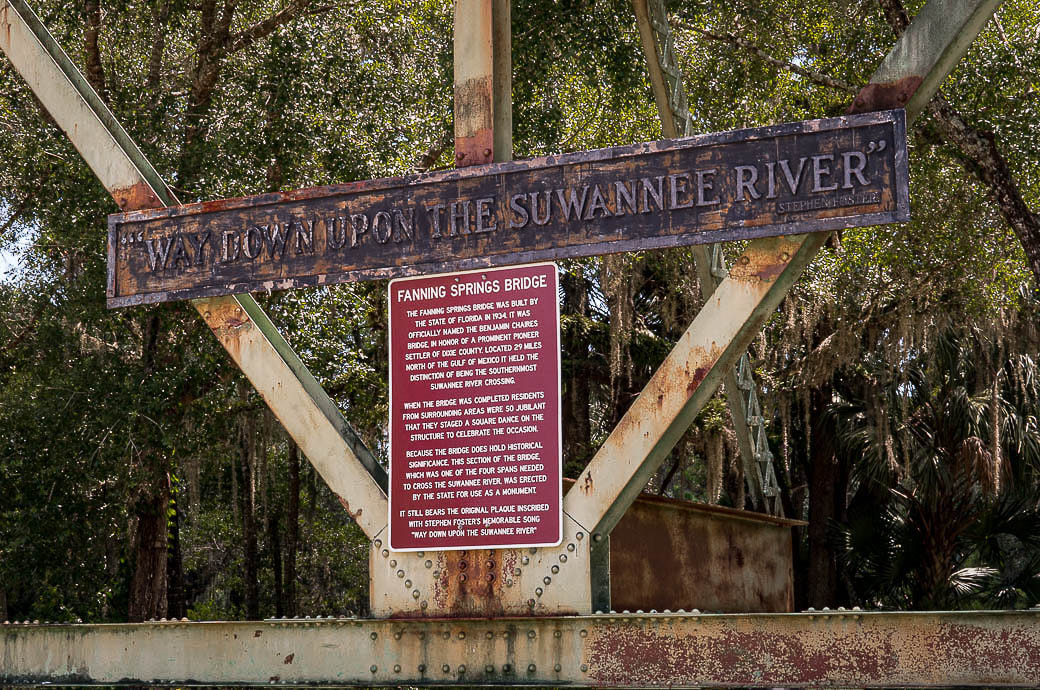
Historical Marker Database ... "In 1934 it was officially named the Benjamin Chaires Bridge in honor of a prominent pioneer settler of Dixie County. Located 29 miles north of the Gulf of Mexico, it held the distinction of being the southernmost Suwannee River crossing. When the bridge was completed residents from surrounding areas were so jubilant that they staged a square dance on the structure to celebrate the occasion. Because the bridge does hold historical significance, this section of the bridge, which was one of four spans which was needed to cross the Suwannee River, was erected by the State for use as a monument. It still bears the original plaque inscribed with Stephen Foster's memorable song "Way Down Upon the Suwannee River." (https://www.hmdb.org/)
- - - - - - - - - - - personal notes - - - - - - - - - - - -
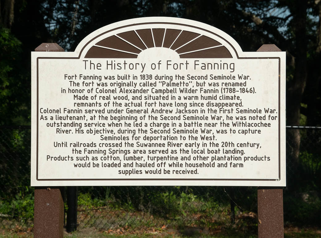
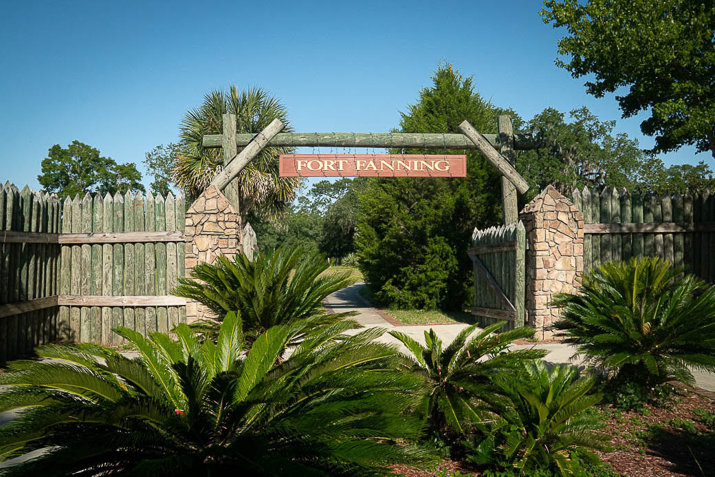
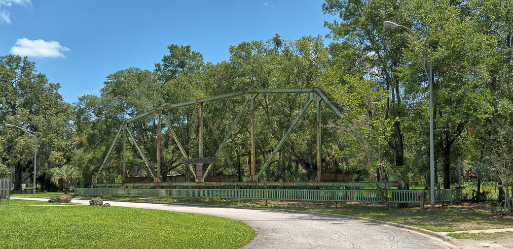
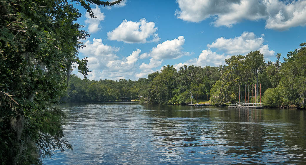
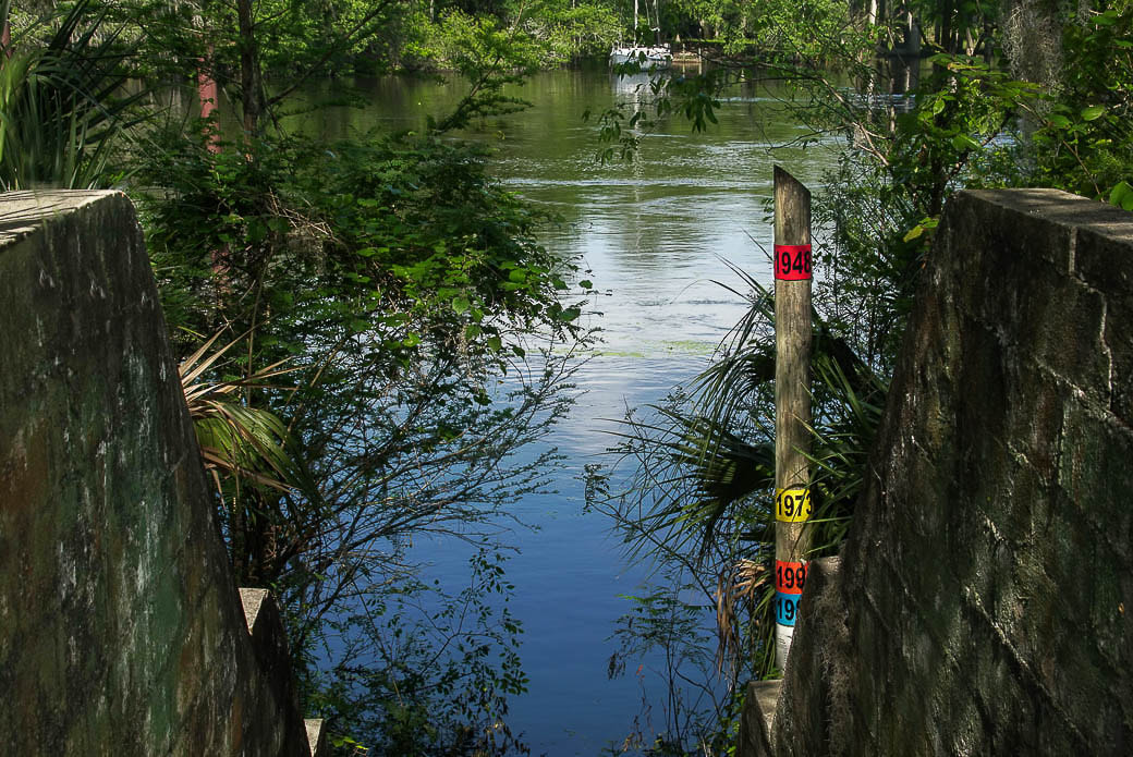
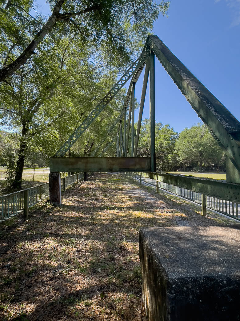
This destination is one of several 'emergency' breaks when we have too much coffee on the road and cannot make our normal pit (pee) stop. From the parking lot stairway, you have a good view of the Suwannee River. Also, and the truss section from the original bridge is immediately seen upon entry. On our last visit we found a flood marker at the river's edge showing flood levels reached over different years. It is amazing how high the Suwannee River can rise under severe weather conditions! Just aross Rt19. on the east side are the remains to the entrance to what was Fort Manning.
Resources:
Fort Fanning exploresouthernhistory.com/fortfanning.html
Fanning Springs Bridge www.hmdb.org/m.asp?m=17709
- - - - - - - - - - - personal notes - - - - - - - - - - - -
This destination is one of several 'emergency' breaks when we have too much coffee on the road and cannot make our normal pit (pee) stop. From the parking lot stairway, you have a good view of the Suwannee River. Also, and the truss section from the original bridge is immediately seen upon entry. On our last visit we found a flood marker at the river's edge showing flood levels reached over different years. It is amazing how high the Suwannee River can rise under severe weather conditions! Just aross Rt19. on the east side are the remains to the entrance to what was Fort Manning.
Resources:
Fort Fanning exploresouthernhistory.com/fortfanning.html
Fanning Springs Bridge www.hmdb.org/m.asp?m=17709